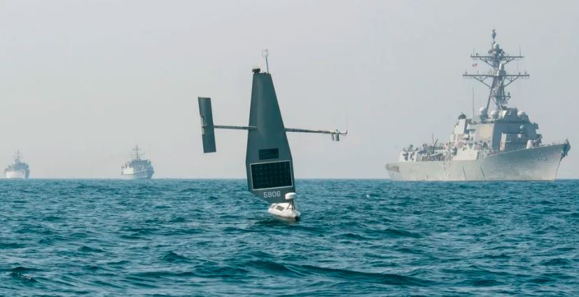
As important energy and communication networks connect different nations and continents, governments around the world are becoming increasingly curious about what goes on below the waves. According to CEO Richard Jenkins, Saildrone, a U.S. maker of small and medium unmanned surface vessels (USVs), will see an increase in the number of seabed reconnaissance flights its platforms conduct in 2023 across the Atlantic, Pacific, and Middle East.
The Essence of Seabed Mapping
Submarine operations and the emerging field of seabed warfare both benefit from an understanding of the ocean floor. Jenkins stated that the company works closely with the U.S. Navy, with Saildrone often operating the platforms and the service purchasing the obtained data. He also said that “There is no excuse today for a country to not have these capabilities,” while referring to the seabed activities that have happened.
The Explorer, a 23-foot-long solar and wind-powered system, was first put through its paces in the Gulf of Aqaba in January 2022 by the United States Naval Forces Central Command (NAVCENT).
At least one hostile maritime organisation has found that vessels equipped with sensors make for a particularly interesting target. Iran’s Islamic Revolutionary Guard Corps Navy (IRGCN) made an unsuccessful attempt in August 2022 to seize a Saildrone Explorer that was being operated by the United States 5th Fleet in the Arabian Gulf. The Saildrone Explorer was eventually recovered by American forces. Because the USV didn’t keep any confidential material on board, the business may easily deploy another one of the hundreds of Saildrones it already has, collecting more expertise along the way in predicting when hostile interference will occur.
Get your ticket for Oi Americas
Join the oceanology community in San Diego from 14–16 February 2023 and discover emerging marine science technology.
The Seabed Mapping Expansion
Jenkins further explained that the Voyager, measuring 33 feet long, and the Surveyor, measuring 65 feet long and propelled by diesel or electric engines, will be used for Saildrone’s expanding activities in the Atlantic and Pacific. The larger platforms are equipped with Kongsberg EM 2040 and EM 304 multibeam echo sounders and a Norbit Winghead i80 sound velocity profiler to carry out comprehensive surveys at sea depths ranging from 300 to 7,000 metres.
- Voyager – it has an average mapping speed of five knots and an endurance of over three months.
- Surveyor – it has a speed average of six knots and can operate at sea for 179 days, constantly gathering data.
- Saildrone Explorer – uses a single-beam Airmar DT800 echo sounder to determine the depth of the seafloor, which is typically employed for contour line mapping in depths up to 100 metres.
Thus, in comparison to the Surveyor, which can stay at sea for only 179 days, the Voyager can map at a speed of five knots and last for more than three months. The Voyager’s endurance is greater than the Surveyor’s. Saildrone Explorer, on the other hand, is most effective in the Arctic and other similarly isolated regions where bathymetric data is scarce because of its long operational life (up to a year). Read More
The three USVs are well-equipped for intelligence, surveillance, and reconnaissance (ISR) missions above and below the water’s surface. These missions include the ability to make strategic observations, follow vehicles, identify threats, and communicate. Jenkins clarified that the vessels are exempt from any American export restrictions and that they only conduct operations overseas with other nations that have partnerships with the United States.
Now is the time to begin ocean and waterway preservation efforts. Oceanology International Americas is the best place to learn about cutting-edge ocean technology and network with experts from marine science and ocean technology communities throughout the world.
Get your ticket for Oi Americas
Join the oceanology community in San Diego from 14–16 February 2023 and discover emerging marine science technology.


