Guest post: Robert Bowen, ASL Environmental Sciences
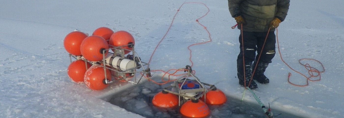
In a collaborative effort with the Nunatsiavut Government and Dalhousie University to measure ice, water current and other physical and biological properties of the marine environment, ASL Environmental Sciences Inc. contributed a prototype Log Ice Profiling Sonar (LogIPS), and on February 15th 2020, the sonar was deployed on a taut-line mooring in the waters off Nain, Nunatsiavut, Labrador. The mooring also contained an acoustic doppler current profiler (ADCP) as well as data loggers for chlorophyll, turbidity, temperature-salinity and dissolved oxygen. The mooring was deployed through a hole cut in the sea ice, with an open-water recovery planned for later this year.
The deployment was part of a project run by the Nunatsiavut Government to collect information about the sea ice environment on the Labrador coast using a variety of data sources and multimedia communication tools. The project aims to map ice hazards and monitor climate-related patterns and changes in the sea ice environment to provide information to Labrador Inuit that can inform travel on the sea ice. Paul McCarney, Research Manager with the Nunatsiavut Government, coordinated the work, with additional expertise provided by Eric Oliver, an Assistant Professor of Physical Oceanography at Dalhousie University. This work is in collaboration with Adrienne Tivy at the Canadian Ice Service and Clark Richards at Bedford Institute of Oceanography. The work relied heavily on the local knowledge expertise and efforts of Joey Angnatok, Mentor-Harvester and Field Researcher with the Nunatsiavut Government, pictured below.
Joey Angnatok preparing ADCP and IPS mooring cages for deployment through the ice.
(Photo credit: James Barlett)
For additional information, please visit www.aslenv.com
or contact Todd Mudge tmudge@aslenv.com


